
Sri Lanka is located in the Indian Ocean, just southeast of India. This South Asian island, sometimes compared to a drop of water suspended beneath the Indian subcontinent, occupies a strategic position between Southeast Asia and East Africa. Its coordinates place it around 7° north latitude and 81° east longitude, making it an entirely tropical territory.
Position of Sri Lanka between India and the Indian Ocean: why this island is so isolated
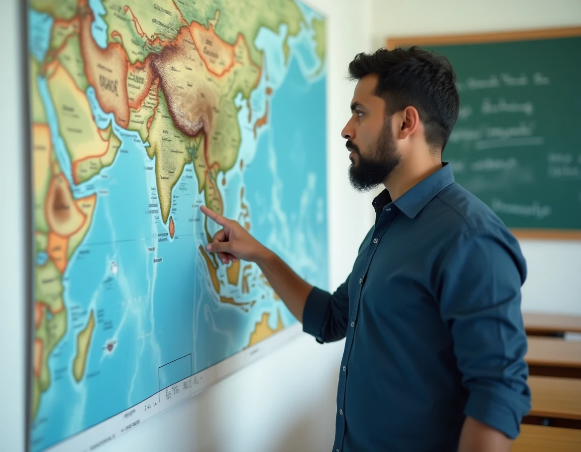
Have you ever looked at a world map searching for Sri Lanka? The island appears as a small dot south of the vast Indian landmass. The Palk Strait, about thirty kilometers wide at its narrowest point, separates the two territories.
Further reading : Kevin Selleck: discover who Tom Selleck's son is and his journey
This shallow body of water has long been traversable on foot during low tides, thanks to a chain of sandbanks known as Adam’s Bridge. This geological detail explains the ancient cultural exchanges between southern India and Sri Lanka, while maintaining an island isolation that has shaped distinct flora and fauna.
By visualizing Sri Lanka on the world map, one better understands its role as a maritime crossroads: the island lies on major trade routes connecting the Persian Gulf to Southeast Asia. Colombo, the economic capital, remains a major port in this area of the Indian Ocean.
You may also like : The Unseen Diversity of Wildlife: Spotlight on Rare and Exotic Species
Relief of Sri Lanka: from coastal beaches to central mountains
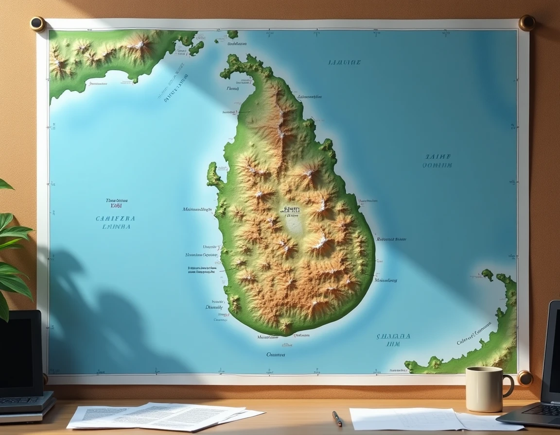
Sri Lanka is not just about its beaches. The interior of the island hides a central mountain range, with its highest point, Pidurutalagala, reaching 2,524 meters. For a country of this size, it is a remarkable elevation.
The relief is divided into three distinct levels. Coastal plains encircle the island all around, with a coastline of 1,340 kilometers. Moving towards the center, an intermediate plateau covered with tea plantations occupies a band between 300 and 900 meters in altitude. Then come the high plateaus, above 1,000 meters, where the climate becomes cool and misty.
Ella and the high plateaus: a terrain that attracts hikers
This tiered geography has concrete consequences for tourism. The regions of Ella and Haputale, located in the central massif, are experiencing increasing visitor numbers. Ella Rock has been subject to a paid access regulation since 2025, proof that these mountain landscapes are becoming as attractive as the coasts.
The train journey between Kandy and Ella traverses this terrain from end to end. The line winds between tunnels, colonial bridges, and hillside tea plantations. This route offers a vivid portrayal of the island’s topography, from the central plateau to the enclosed valleys.
Area and density of Sri Lanka compared to neighboring countries
Sri Lanka covers 65,610 km², roughly the size of Ireland. It is a small country on the world map, but its population density reaches 338 inhabitants per km², placing it among the most densely populated territories in South Asia.
With 22.2 million inhabitants, the island concentrates as many people as some medium-sized European countries. This density is unevenly distributed: the west and southwest coast, around Colombo, absorb a disproportionate share of the population, while the north and east remain less urbanized.
Some useful geographical markers to locate Sri Lanka:
- Continent: Asia, South Asia region, southeast of India
- No land borders: it is an entirely island state, separated from India by the Palk Strait
- Time zone: UTC+5:30, which is 4 and a half hours ahead of Paris in winter
- Two capitals: Sri Jayawardenepura Kotte (administrative) and Colombo (economic)
Tropical climate and monsoon: what Sri Lanka’s geographical position changes for travelers
Sri Lanka’s position just above the equator gives it a tropical climate influenced by two distinct monsoons. The southwest monsoon hits the west coast and mountains from May to September. The northeast monsoon affects the east coast from October to January.
This alternation creates a notable feature for travelers: there is always a part of the island where the weather remains dry. When the southwest coast receives heavy rains, the east coast enjoys sunny days, and vice versa.
Coastal erosion: a visible threat on the southern beaches
The coastal geography of Sri Lanka is undergoing measurable transformations. The south and southwest coasts have been affected by an increase in erosion and vulnerability of tourist beaches since the mid-2010s. Authorities are increasing the number of seawalls and sand replenishments, with construction restrictions in coastal areas.
For fishing villages located on the front lines, this erosion changes the coastline’s appearance year after year. Southern beaches like Hiriketiya, popular with surfers, are not spared from this phenomenon.
Languages and religions: the diversity of a compact island
The geography of Sri Lanka is not only read on a physical map. The distribution of communities also reflects the island’s topography.
- Sinhala is spoken by about three-quarters of the population, mainly in the south and west
- Tamil is the language of about one-fifth of the population, concentrated in the north and east
- Buddhism is followed by the majority of the inhabitants, followed by Hinduism, Islam, and Christianity
Nine provinces and twenty-five districts divide this small territory, each with its own cultural and climatic characteristics. This mosaic is better understood when observing the map: the central mountains have long served as a natural barrier between communities in the north and south.
Sri Lanka concentrates on less than 66,000 km² a geographical diversity that much larger countries struggle to bring together: mountains over 2,500 meters, tropical forests, rice plains, mangroves, and coral reefs. This compression of relief and ecosystems remains its most striking feature on the world map.